After taking the helm of the Oregon Trail project in the autumn of 1984, one of my first decisions was that the new game would be heavily based on real geography, woven throughout the game. The original game did not mention any geographic locations at all, other than the two endpoints of the journey. During the 2000 miles between those two points, the player was never given any geographic information at all, except for the frequent mention of “mountains” after the 900-mile mark. I envisioned a very different experience that would incorporate a great number of new geographic details, in addition to the new historical details.
Of course, it was a big leap from aspiring to include real geography to actually doing so. In my first rough conception of the game, I imagined that the player would face a long series of tasks, at various points along the route, corresponding to tasks that real players on the Oregon Trail would have had to deal with. These tasks would often relate to the local geography at that point. Eventually I hit upon the idea of basing the game not on a series of mandatory tasks, but on a series of real landmarks. The player would travel from landmark to landmark – approximately 16 in all – and the activities available at each landmark would be based on the type of landmark.
I imagined that most (but not all) of the landmarks would fall into three categories: 1) river crossings, 2) forts, and 3) noteworthy natural features.
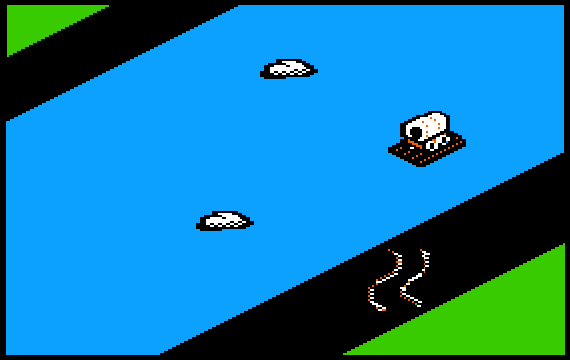
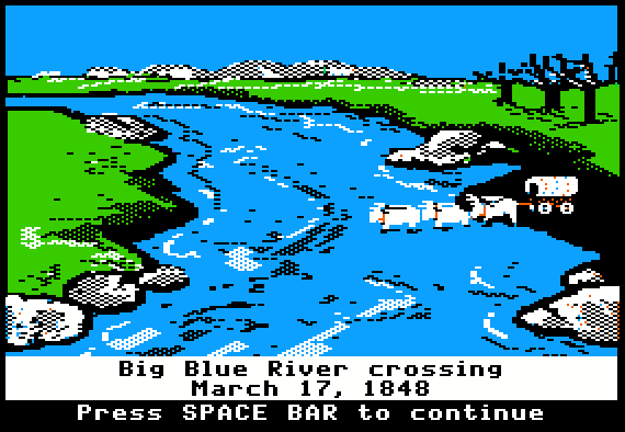
The original 1971 design did not include any river crossings. Incorporating these crossings was one of the most important new features in my design for the 1985 product. But my dilemma was that travelers on the real Oregon Trail crossed a great number of rivers, far too many to include in the game. Ultimately I choose just four river crossings to represent the experience. (See the story on crossing rivers for more details.)
The original 1971 design included several forts where the player could purchase supplies. However, these forts were never named or shown, and they appeared at regular 4-week intervals, regardless of the player’s actual location on the trail. I decided to use real forts, and to place them at their actual locations on the trail. However, the list of available forts along the real Oregon Trail depended on the year of the journey. As time went by, there were more and more forts. My original plan was to set the game in 1847, the same year as in the original game. In that year, Whitman’s Mission was still in existence, but Fort Kearney was not yet open. I vacillated as to which of these two locations was more important to include in the design. I finally decided to go with 1848 as the year of travel, which allowed me to include Fort Kearney, but not Whitman’s Mission. My final list of landmarks included six forts.

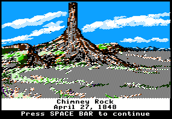
Because of the various guidebooks that travelers purchased prior to taking the Oregon Trail, many of them knew in advance about the natural landmarks along the trail. The most famous landmark was Chimney Rock, but many other landmarks were also described in the books. As with the river crossings, I realized that I had more choices than I could use. So I made a list of the best candidates and studied the choices. As I selected landmarks for inclusion in the game, I would eliminate any candidates that were located nearby. In the case of Chimney Rock, this meant that I had to eliminate Scotts Bluff and Courthouse Rock, two of the better-known landmarks. But the benefit was that the landmarks in my final list were spaced fairly evenly along the trail.
I eventually settled on the following as the final list of 18 landmarks to include in the game:
There are three branch points in the game, where the player must decide whether to go left or right. Consequently there are 20 trail segments in the network connecting these 18 points. However, in a typical game, the player passes just 16 landmarks and travels 15 trail segments.
In the early years of the real Oregon Trail, the trail ended almost 100 miles before the final destination. To complete the journey, it was necessary for emigrants to take a dangerous rafting trip down the Columbia River. However, beginning in 1846, an alternate route for this final segment became available – the Barlow Toll Road. This was a very rough route, and travelers had to pay a toll in order to take it. Therefore some people opted to raft down the river instead.
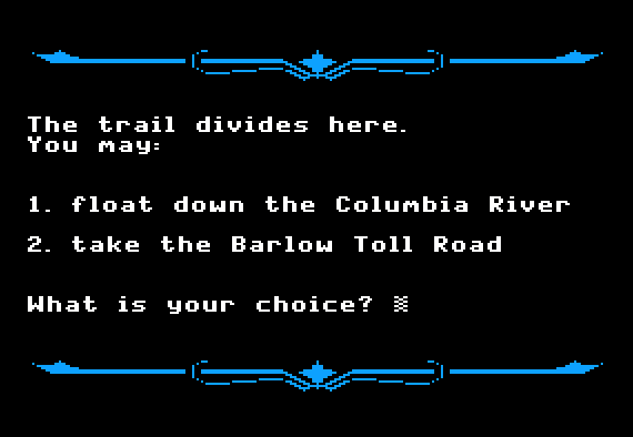
The original 1971 game made no mention of either rafting down the Columbia River, or taking the Barlow Toll Road. Incorporating both of the features into the game was a key part of my strategy for incorporating real geography into the game.
My strategy for incorporating real geography into the game included one other key aspect – to reflect the varying terrain and climate along the way, to the greatest extent possible. I did this through two principal methods, neither of which was present in the original game:
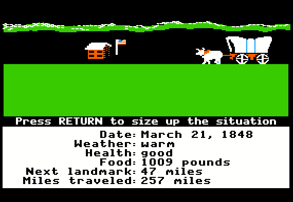
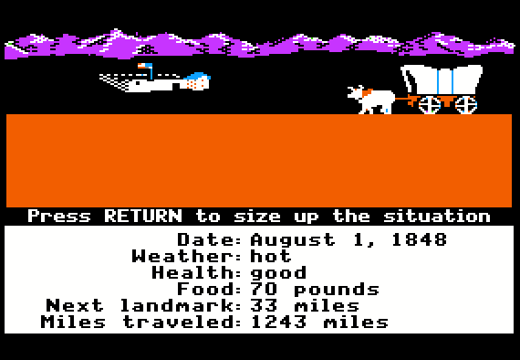
The new design also included one other feature, reminiscent of the original 1971 design (in which mountains are frequently mentioned after the 900-mile mark). On the travel screen in the 1985 design, the background graphic initially indicates a prairie setting – until nearly the halfway point, after which it depicts a mountainous setting.